


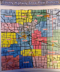
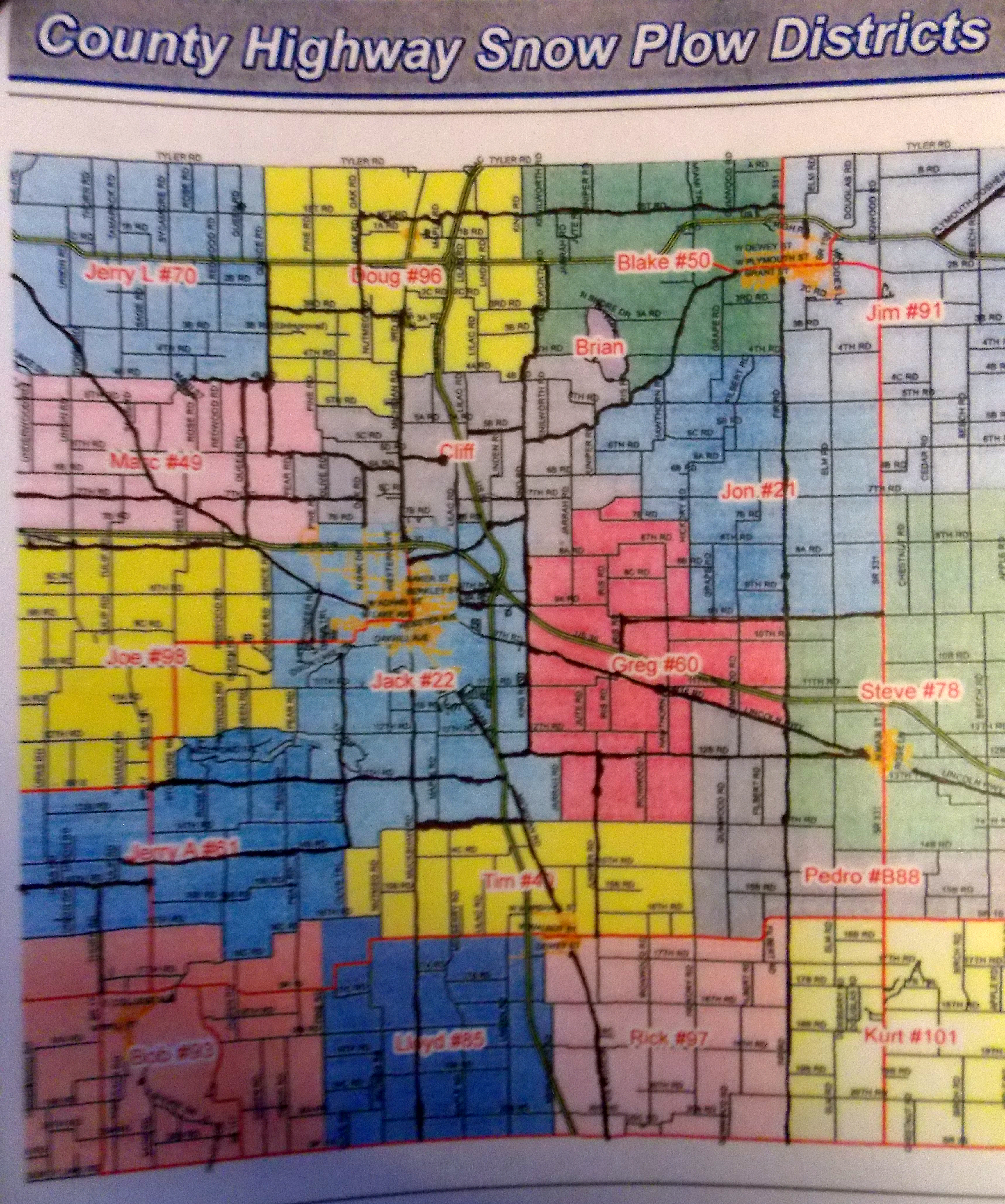
 In early December Jason Peters, Supervisor of County Highways presented the County Commissioner with a map detailing the various territories and main snow plow routes.
Peters said they will hit the main roads first and then move to secondary roads and so forth. He said the main roads should be open within two hours of a snowfall although he said, “If it continues to snow that could change it up a little bit.”
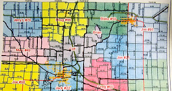
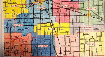
With his veteran crew the county is divided up into 18 areas with a dedicated driver. The each will hit the main roads first in their areas and then move to secondary. Peters said, “No one should be more that 2 to 3 miles from a main road.”
 The following is a list of main roads that will be plowed first north of US 30.
Quince Road from US 6 to 6th Road
4B from Thorn to Quince
Queen from 4B to south of US 30
7th Road from the west county line to Oak
6th Road from Oak to 7B
6A Road from Oak to North Michigan
Oak Road from 1st Road to US 331
North Michigan Road
6th Road to Lilac to 5B to King Road
King Road from US 6 to US 30
Plymouth Goshen from King to 106
Iris from US 30 to 9B
9B from Iris to the county line road
Fir Road from Bremen to Lincolnway
9th Road from US 31 to the city limits
Plymouth Goshen from the City limits to King Road
Elm from 6 to the city limits and
Plymouth Goshen from 6 to the County Line
 The Main Road that will be plowed first south of US 30 are:
Overmyer, Pioneer, Lincoln Highway East and West,
Olive Trail to 14B and 14B to 17
13th Road to State Road 17 to US 31
15th Road from State Road 17 to the county line
Thorn Road from 15th to State Road 17
Muckshaw Road from 110 to the Plymouth City limits
Juniper Road from State Road 10 to 12B
12B from US 31 to Bourbon
King Road from 12B to 110 and
14th Road from US 31 to Muckshaw Road.


